檔案:OttomanEmpireIn1683-zh-classical.png
出自六年制學程
此預覽的大小:637 × 599 像素. 其他解析度:638 × 600 像素 | 1,966 × 1,850 像素。
完整解析度 (1,966 × 1,850 像素,檔案大小:442 KB,MIME類型:image/png)
摘要
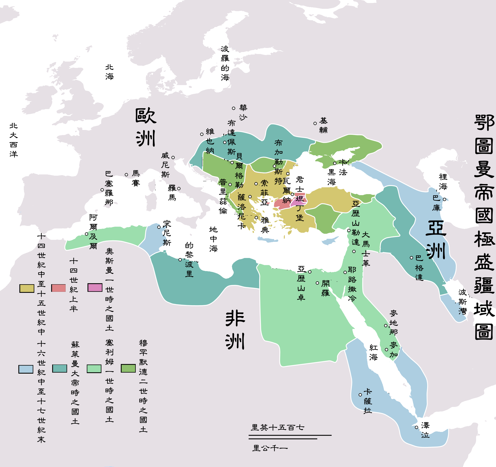
| 描述 | Map depicting the Ottoman Empire at its greatest extent, in 1683. |
| 日期 | |
| 來源 | Self drawn, mainly based on Robert Mantran (ed.), Histoire de l'Empire Ottoman, Paris: Fayard (1989), also en:List of Ottoman Empire dominated territories, Image:Ottoman 1683.png, [1], and [2]. Background map modified from Image:A large blank world map with oceans marked in blue.svg. |
| 作者 | Atilim Gunes Baydin |
| 授權許可 (重用此檔案) |
Permission is given for anyone to use this for any possible purpose. |
| 其他版本 |
[]
|


![[1]](http://fs.huntingdon.edu/jlewis/Syl/IRcomp/Maps/OttomanMap.jpg)
![[2]](http://www.morainevalley.edu/ctl/MiddleEast/images/Map_Ottoman_Empire_expansion_EB.jpg)
Originally picture was uploaded to here.
The Classical Chinese Modification is made by User:Itsmine.
授權條款
| |
此作品已由其作者,中文維基百科專案的AtilimGunesBaydin,釋出至公有領域。此授權條款在全世界均適用。 如果法律不適用時: |
檔案歷史
點擊日期/時間以檢視當時出現過的檔案。
| 日期/時間 | 縮圖 | 維度 | 使用者 | 註解 | |
|---|---|---|---|---|---|
| 目前 | 2007年5月11日 (五) 14:44 | | 1,966 × 1,850(442 KB) | Itsmine |
連結
以下的2個頁面連接到本檔案: